
To download and print a map: Look for a map that covers the area that you’d like to hike; each is labeled with a Map #. Scroll down to the “PDF of Map #” that you would like to print out and click on its blue link. The trails covered are enumerated with a link to the description of each in the Trails Overview. Maps 1 & 2 are large areas; Maps 3 to 10, below, are of smaller areas. Click here for downloadable maps of Mountain Bike Routes in Norwich. Some suggested loop and out-and-back hikes are tabulated at Norwich Hikes.
PDF of Map 1: Gile Mountain, Blue Ribbon (with Connector), Brookmead, Parcel 5, Converse, and Brown Schoolhouse Trails
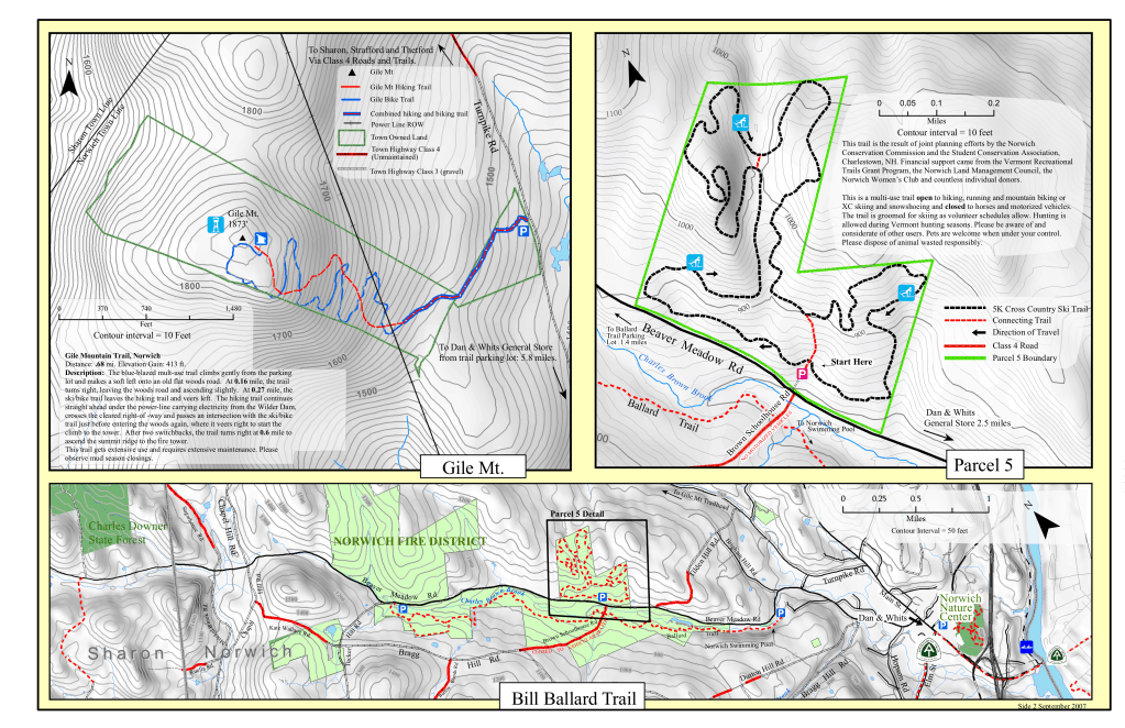
PDF of Map 2: Blue Ribbon Connector, Brookmead, Parcel 5, Ballard, Converse, Brown Schoolhouse, Burton Woods, Appalachian, Tucker, Cossingham, and Heyl Trails

PDF of Map 3: Parcel 5, Ballard, Converse, Brown Schoolhouse, Burton Woods, Appalachian, Tucker, Cossingham, and Heyl Trails
PDF of Map 4: Bill Ballard and connecting trails
PDF of Map 7: Brookmead Trails
PDF of Map 8: Gile Mountain Trails
PDF of Map 9: Cossingham, Tucker and Appalachian trails
PDF of Map 11: Bradley Hill Trail
All-in-one format
See the latest version of the all-in-one 11 x 14, two-sided trail map, here.
Make your own map, using CalTopo, by clicking here! When the page is open, look for Print along the top row and choose “Printed maps”

2007 Legacy maps
Feedback: If you want to discuss a problem with our trails or with our website, please contact norwichtrails@gmail.com.
